Solutions
Find your suitable features
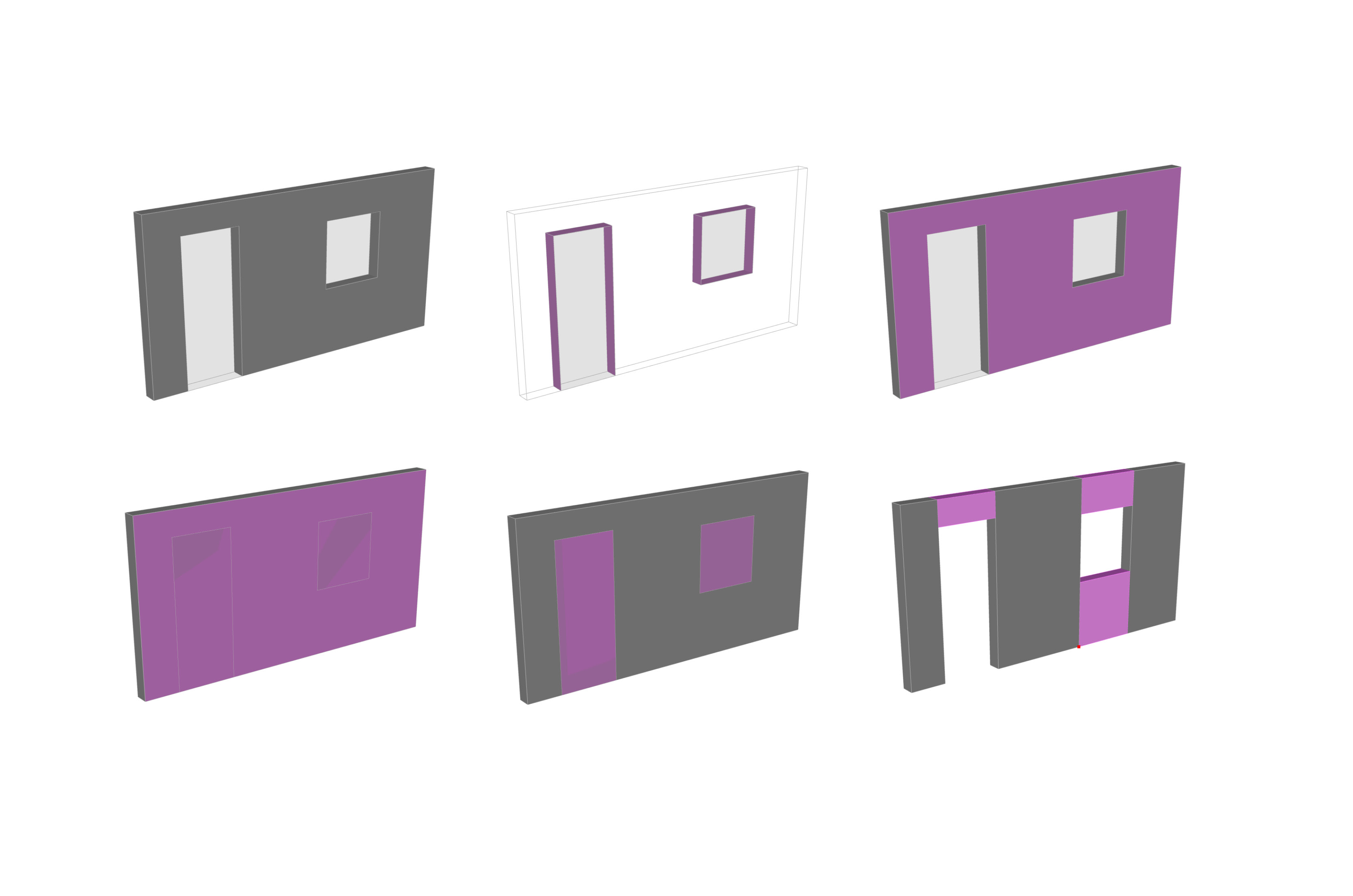
Modeling
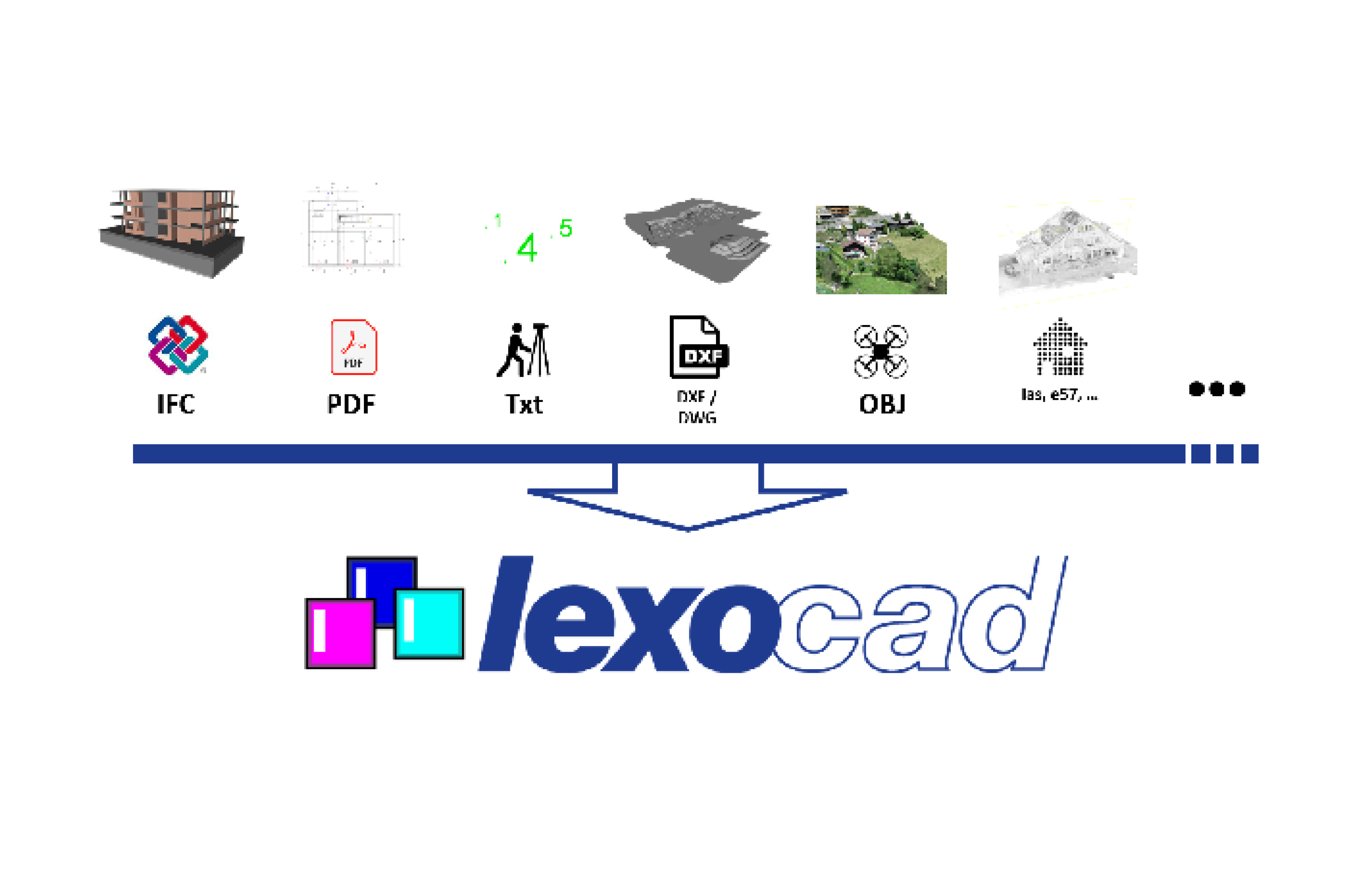
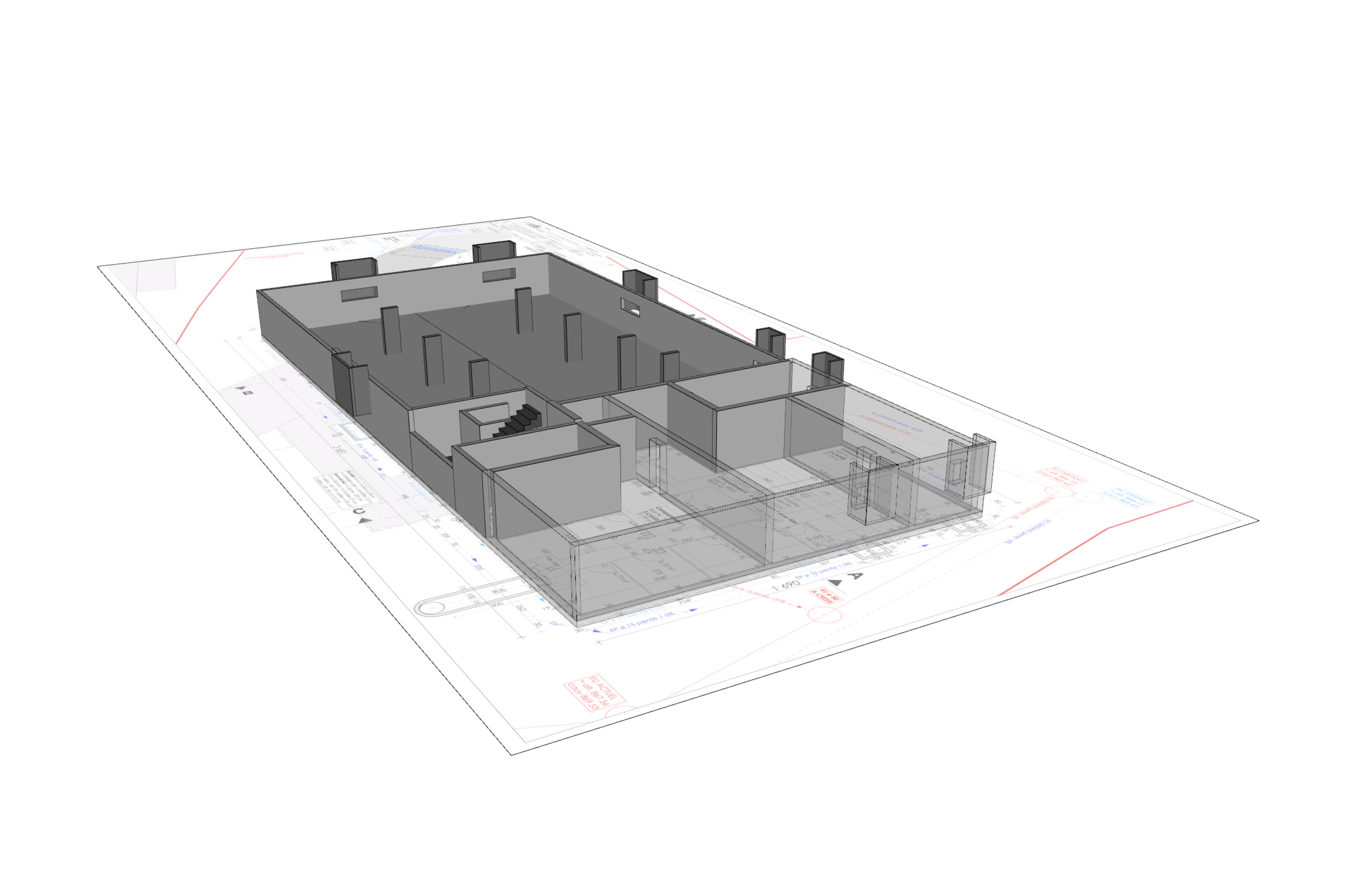
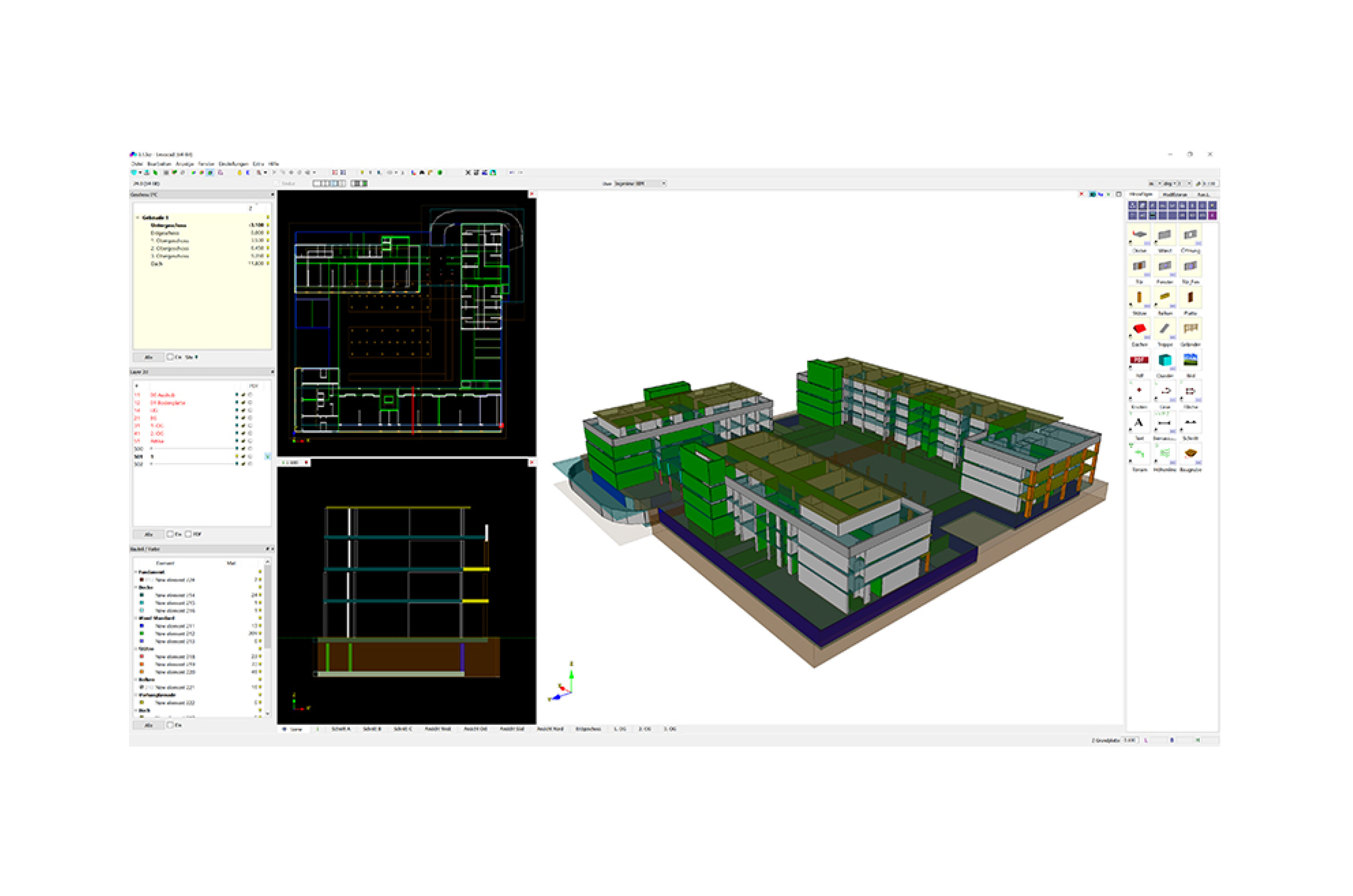
Lexocad
Lexocad can be used to model buildings. PDF plans can be imported to create, for example, a building in 3D quickly and easily with Lexocad's modeling features.
You can create predefined elements to get the maximum speed in modeling. In addition, there are cutting and welding functions that you can use.
The cutting and viewing functions in Lexocad help you have all aspects of the model under control.
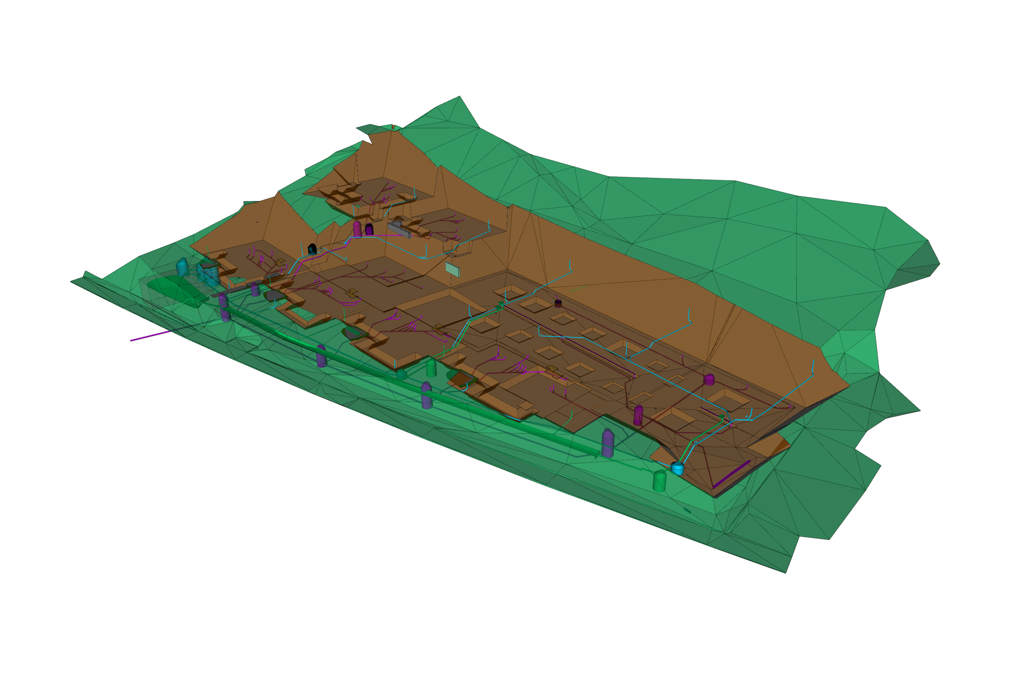
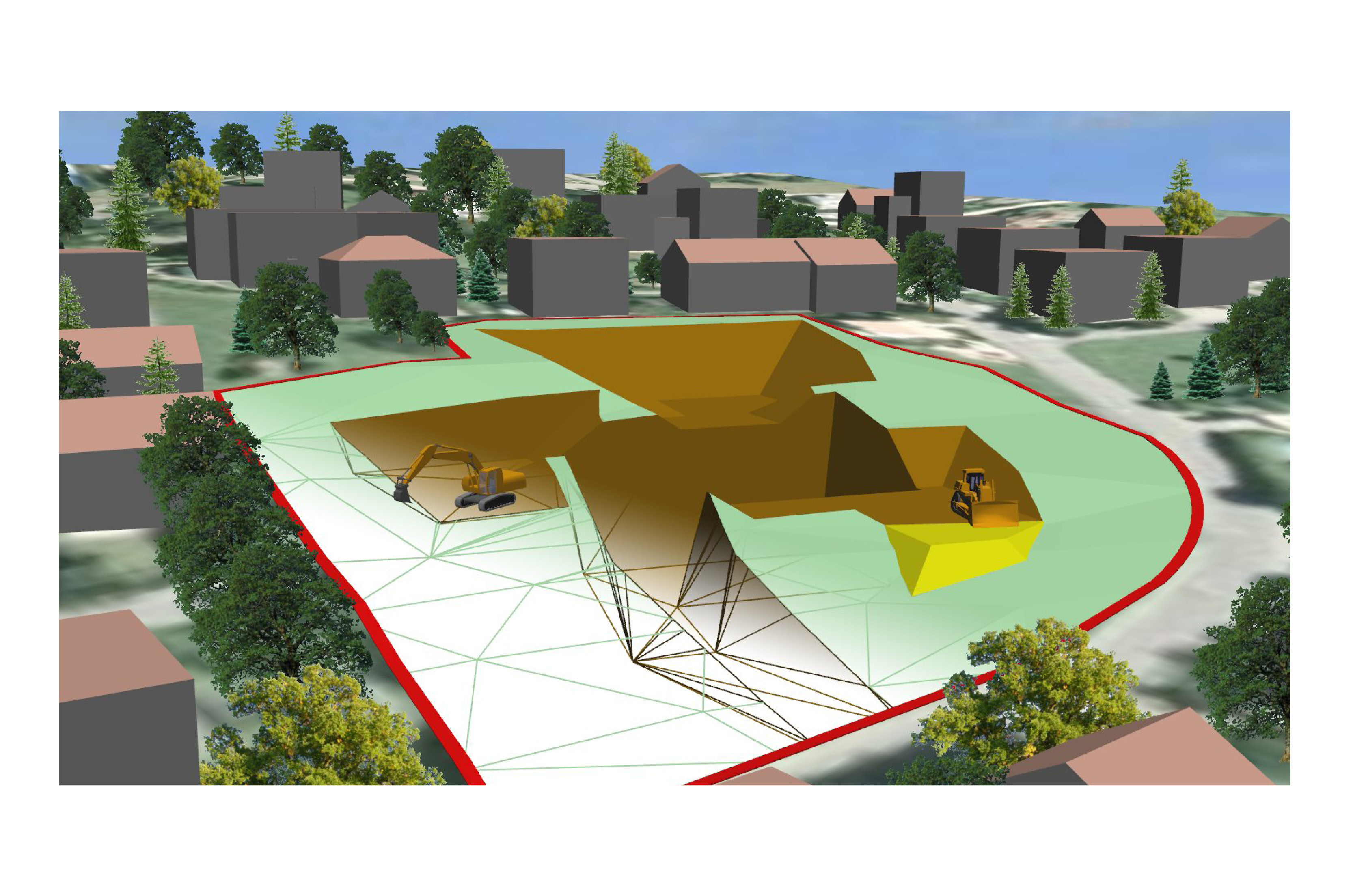
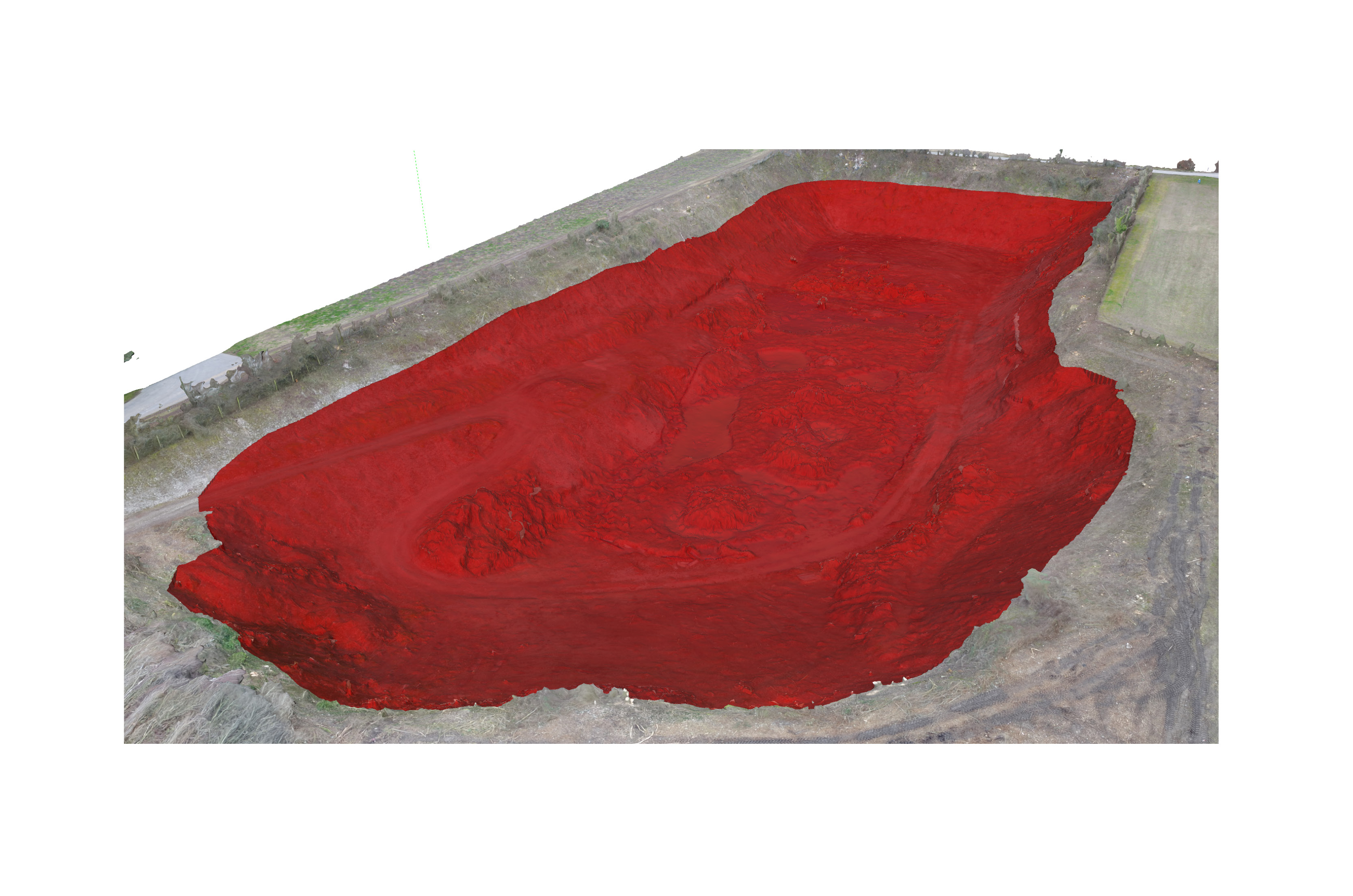
Excavation
Lexocad
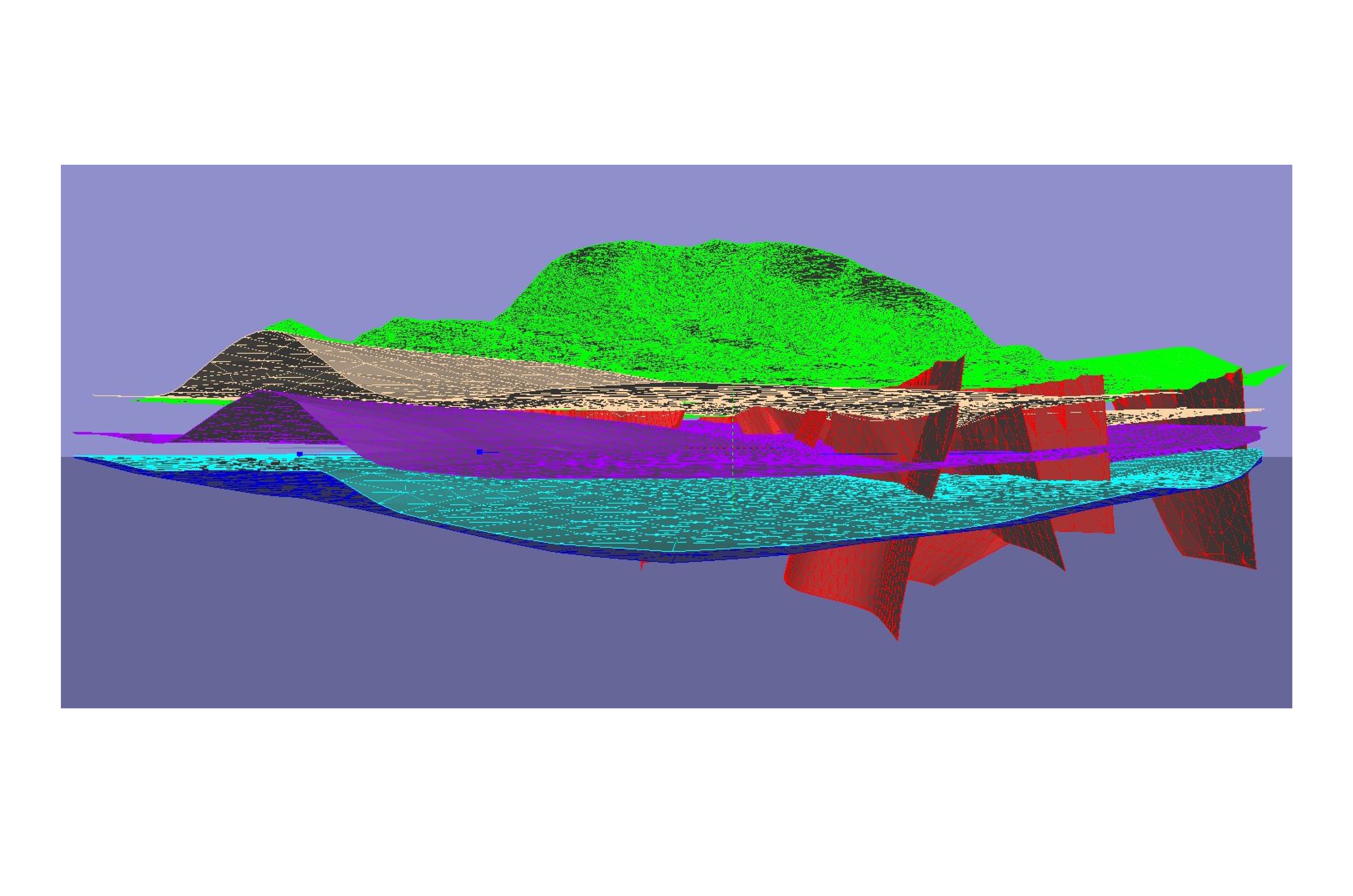
Excavations can be modeled to visualize the excavation in three dimensions and to determine the quantities. Nodes can be set to be further used for surveying.
- Volume
- Special civil engineering
- Excavation fuses
Lexocad offers besides the intersection of terrain the possibility to export a single terrain only as a triangle mesh instead of a volume. Thus, excavation volumes can be divided according to this triangular mesh, which represents, for example, an earth layer.

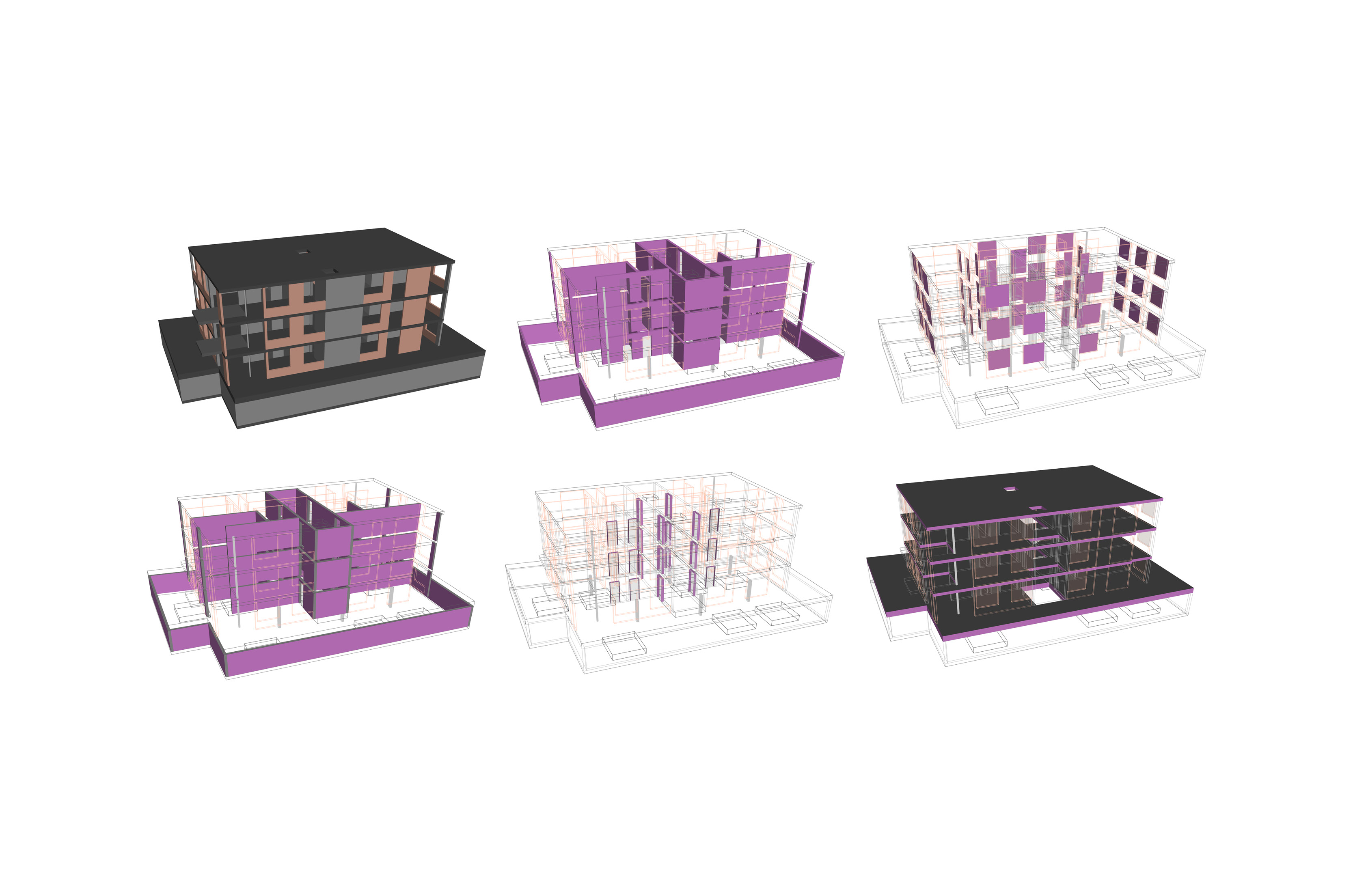
IFC Model Analysis & Editing
Lexocad
IFC models can be imported, analyzed, edited and exported.
Find the relevant elements for your work step at the click of a button and quickly get an overview of the conditions of the structure. For example, visualize the elements of a floor, a specific formwork type or all elements of the same concrete type.
You can modify existing model information (property sets and properties) or create and add your own.
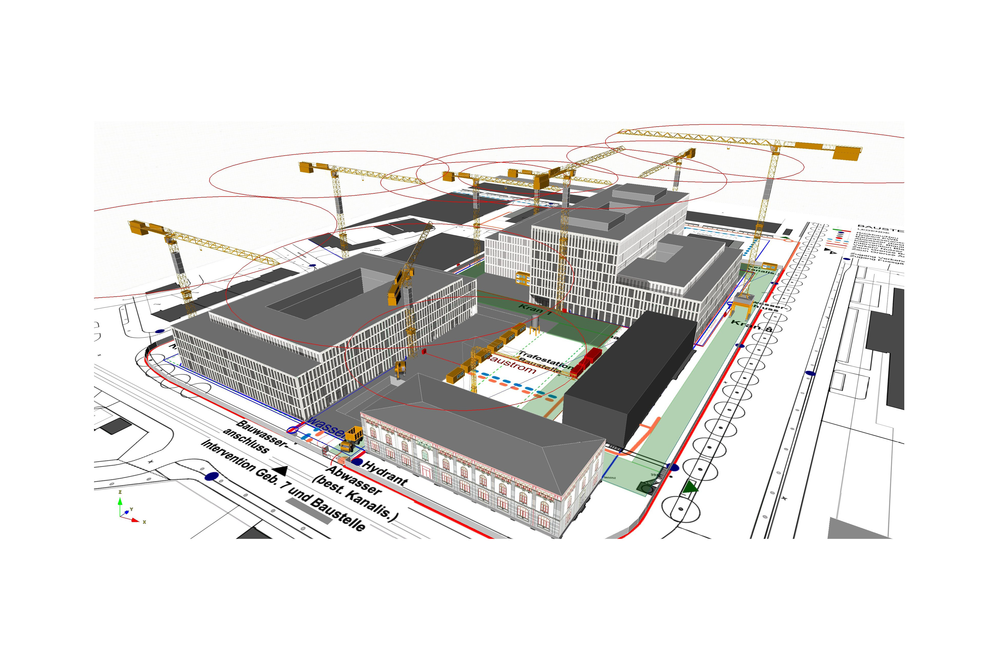
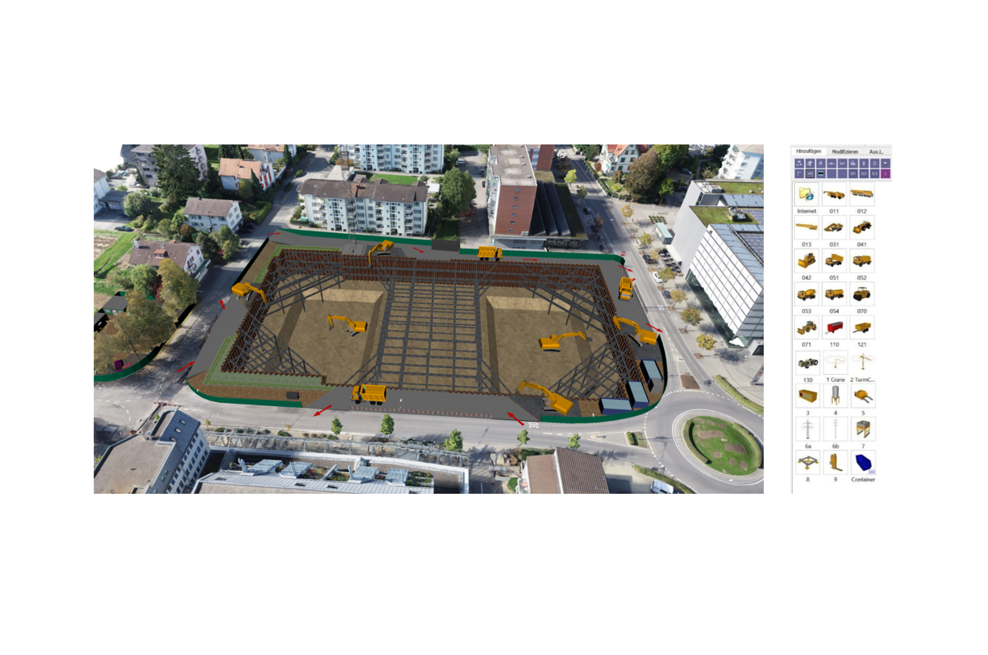
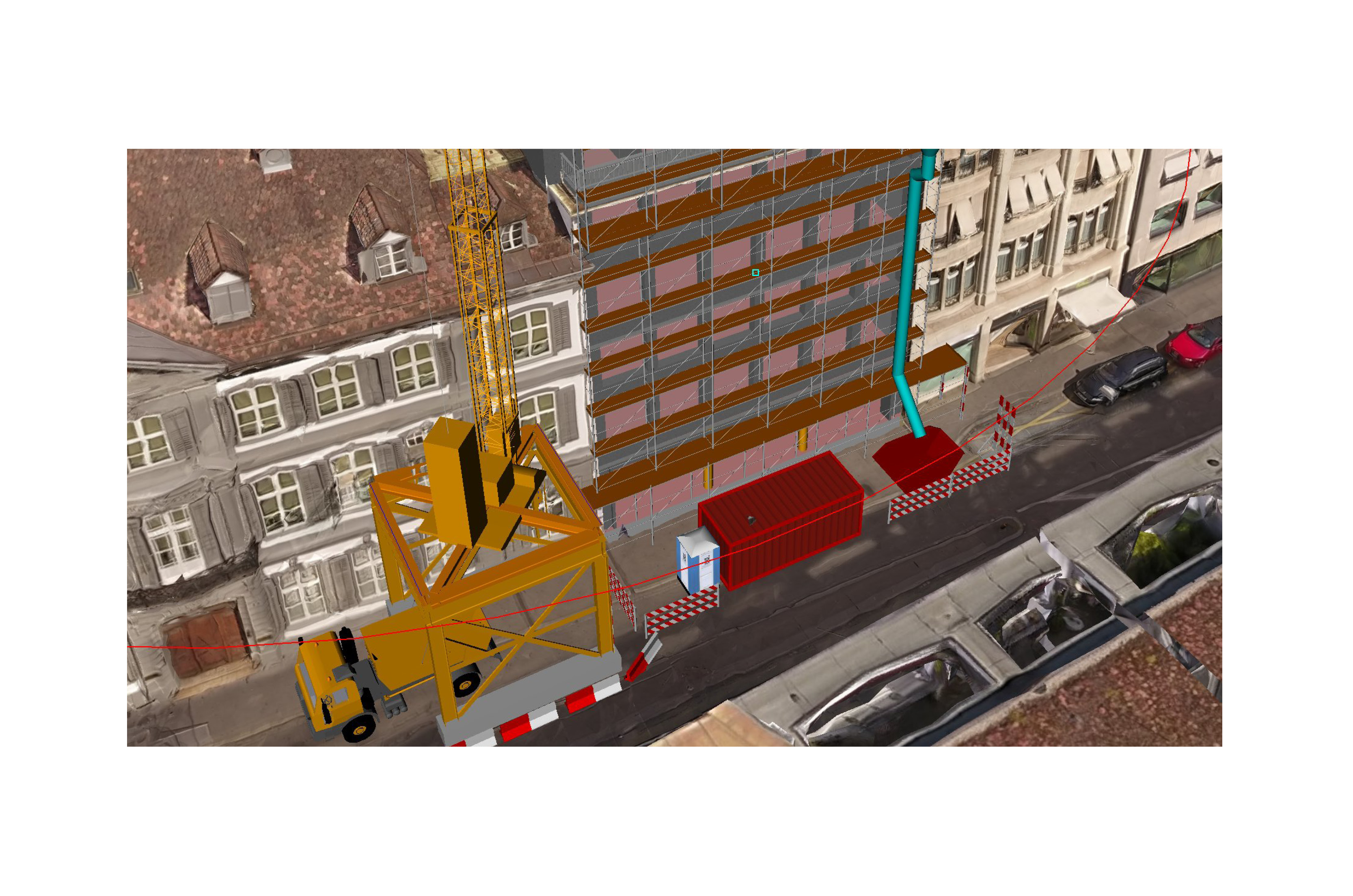
Site installation
Lexocad
With Lexocad you can easily and quickly plan and visualize your construction site. Create a construction site installation plan and check the feasibility and processes.
With the help of the available catalog components as well as the parameterized components, you can carry out your construction site installation planning in a short time. Drag and drop crane, vehicles, fence, containers, etc. from the library into the workspace to complete your site installation. Envelope areas can be modeled and text can be added. Furthermore, 3D texts as well as images can be added.
The 3D site installation design can be shared with others as a PDF, as an IFC model or via our BIMteam platform.
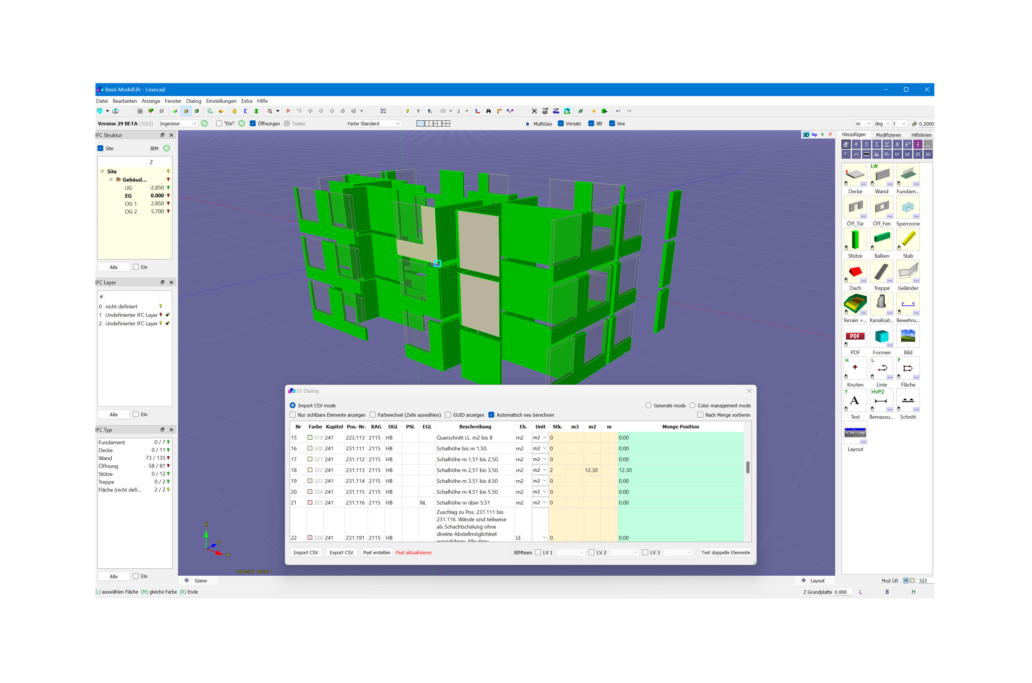
Quantity determination
Lexocad
Lexocad offers various quantity takeoff options with which quantities can be determined quickly and easily. Individual quantities can be determined manually or automated quantity takeoff functions can be used. Whether from PDF or from model, Lexocad offers innovative quantity takeoff functions for both areas. Possible areas of application include:
- Quantity determination of items for the creation of bills of quantities
- Quantity verification for the calculation of a lump sum
- Quantity determination for billing
- From drone model e.g. determine excavation volume
It is also possible to import the items of a bill of quantities and thus assign the determined quantities directly to the items of the bill of quantities.
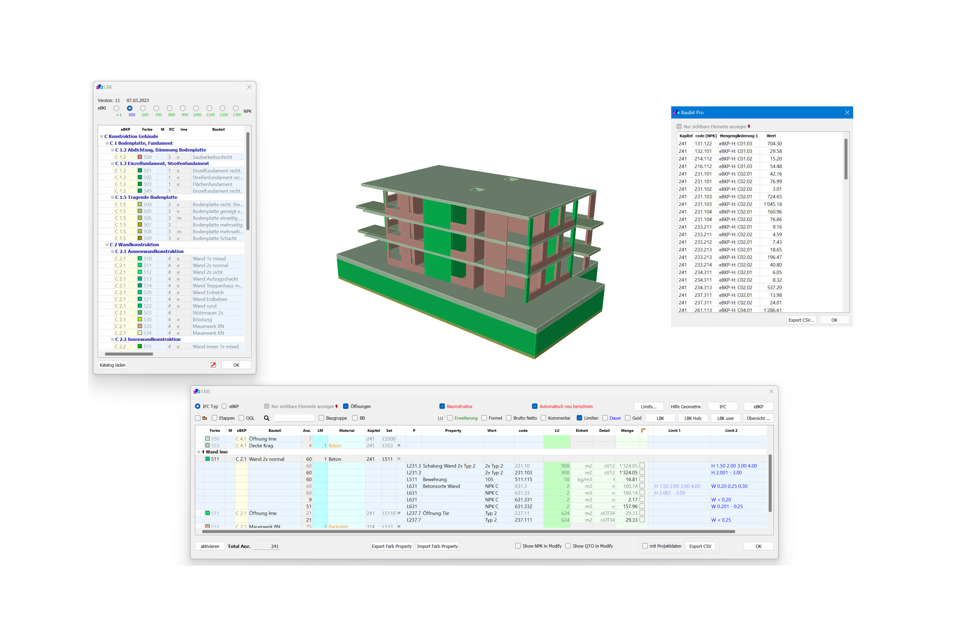
Automated quantity determination
Lexocad
With the customizable Lexocad Parts Catalog (LBK), quantities can be determined automatically, e.g. to create a bill of quantities according to NPK. You can set up the Lexocad parts catalog in such a way that the quantities are determined automatically according to your needs.
If an IFC model has been imported, there are various clean-up functions to ensure that the quantities determined are also correct.
The determined items can be further used via a CSV export.
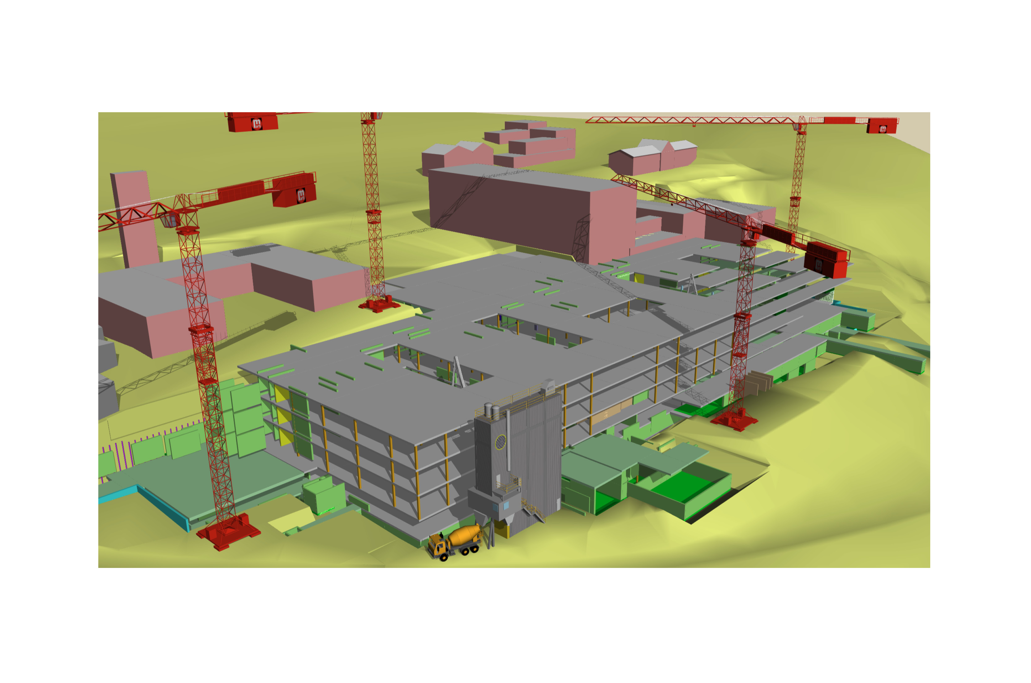
Construction scheduling
Lexocad
In the 4D Stages dialog, you can import MS Project data or create your own construction stages. You can link these to elements and show or hide them on the desired date. The planned construction process can be imported into MS Project to use it as a construction program.
Thus you have a 3D representation of the construction process and can visualize the construction status of each day in 3D at the click of a button.
If the quantities of the construction have been determined with Lexocad and performance values per unit have been stored, the duration of the stage can be determined automatically.
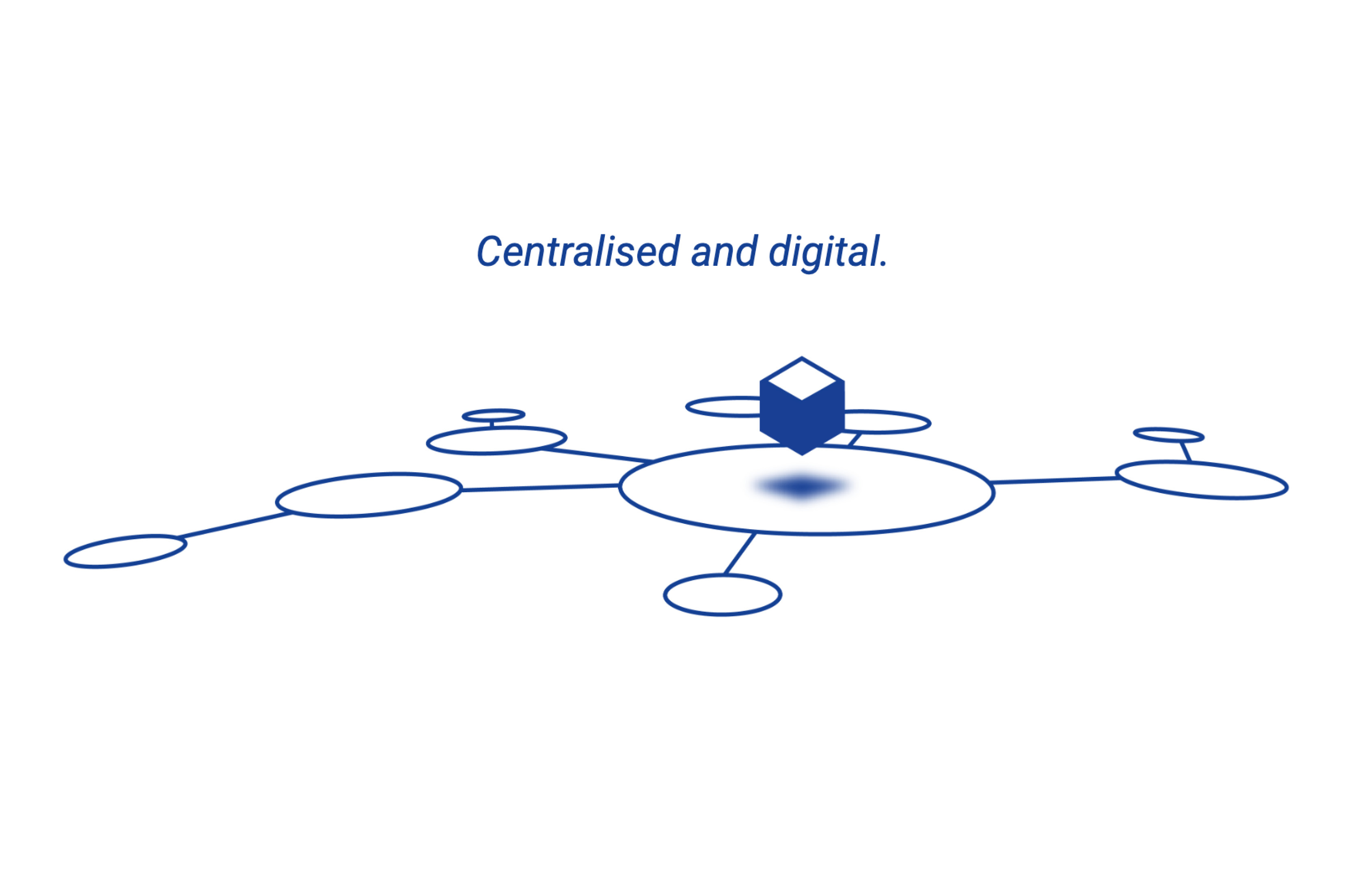
Collaboration
BIMteam
The cloud-based platform can be used as a central access point for all project information, documents and models.
The common functions of a CDE (Common Data Environment) are available and enable collaboration with different project teams as well as a "single source of truth". Project data can be conveniently loaded onto the platform using drag-and-drop. Common file formats can be opened, viewed and, depending on the format, further processed directly on the platform. The platform also offers advanced model and data management with versioning, activity logging, and permission conzpet for smooth collaboration.
Learn more at www.bimteam.com
BIMtoField
BIMteam
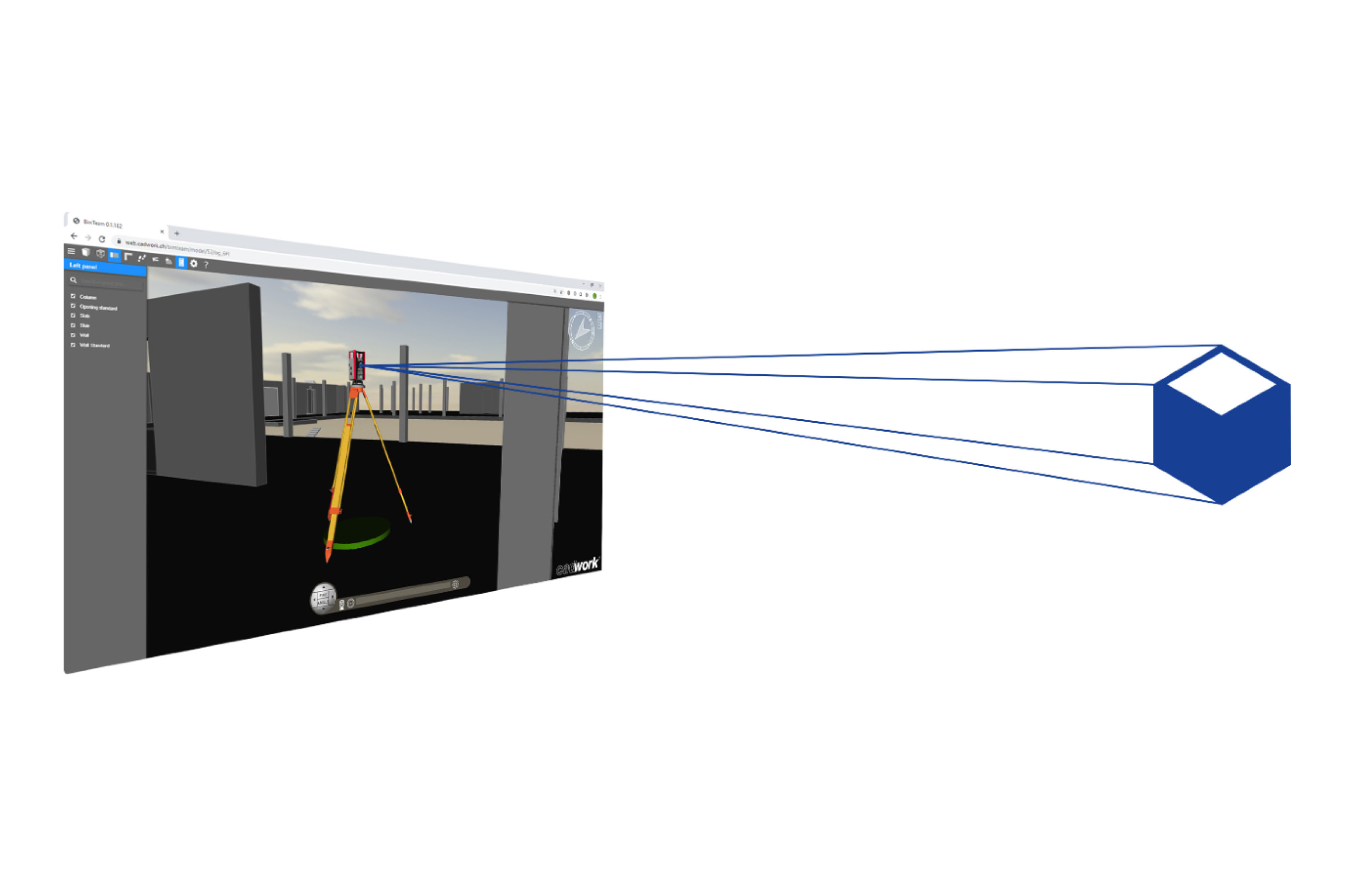
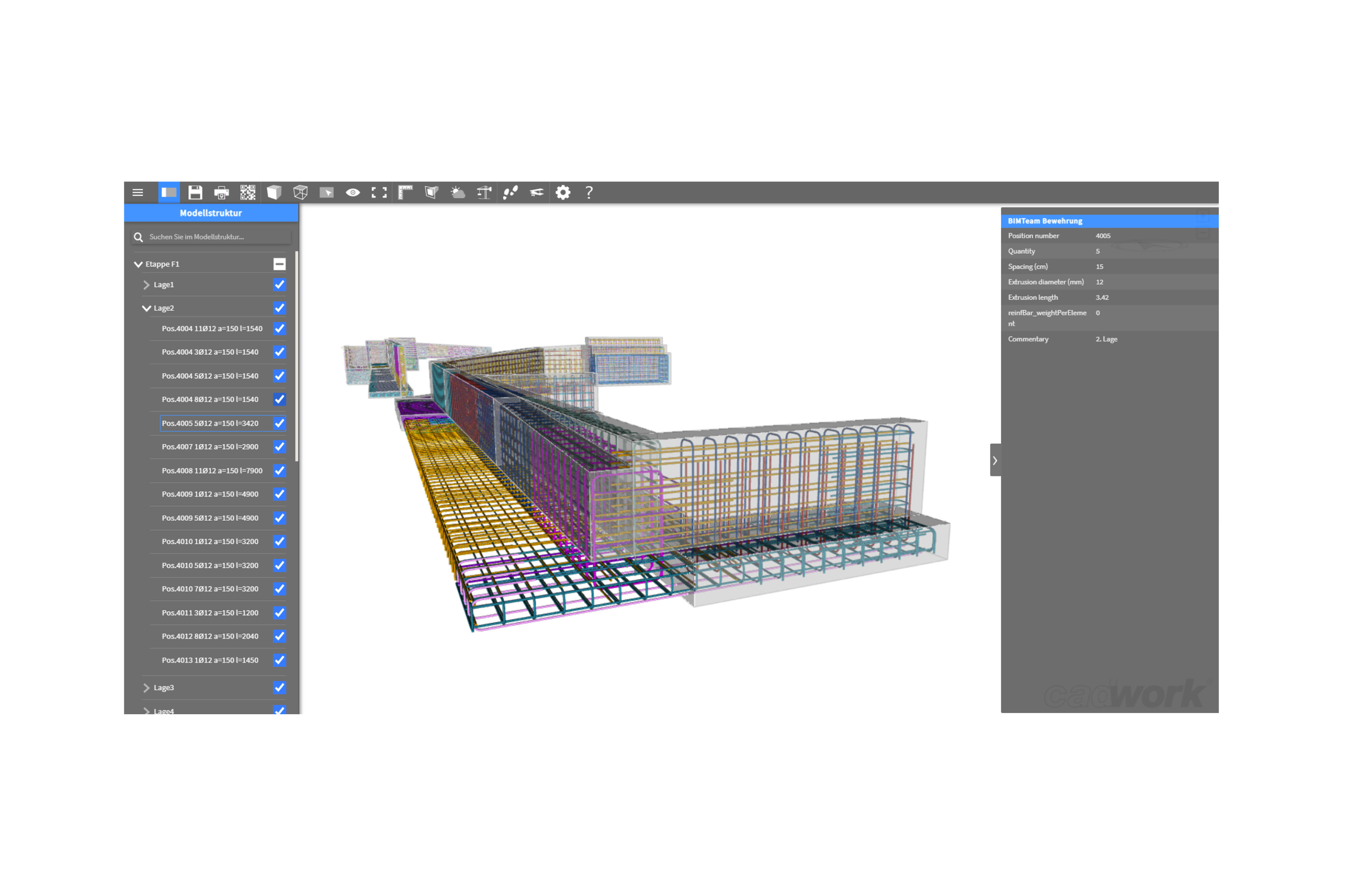
The BIMteam viewer allows you to conveniently retrieve, share or present building models. Models can be opened through a generated partial link, device and location independent in the browser, all without the need for tedious installation or login. Integrated viewer functions support you in generating sections or measuring distances.
Metadata of the model elements can be displayed and retrieved in the form of property sets. The construction animation function allows you to play back the construction process and watch your model grow. The models can also be ideally presented and put in the best light with the help of the extensive view functions. Our viewer can do more: Connect the coordinated model with total stations or GPS to stake out directly with the help of the viewer (BIMtoField). Furthermore, field points can be saved and compared with the planning model.
Learn more at www.bimteam.com
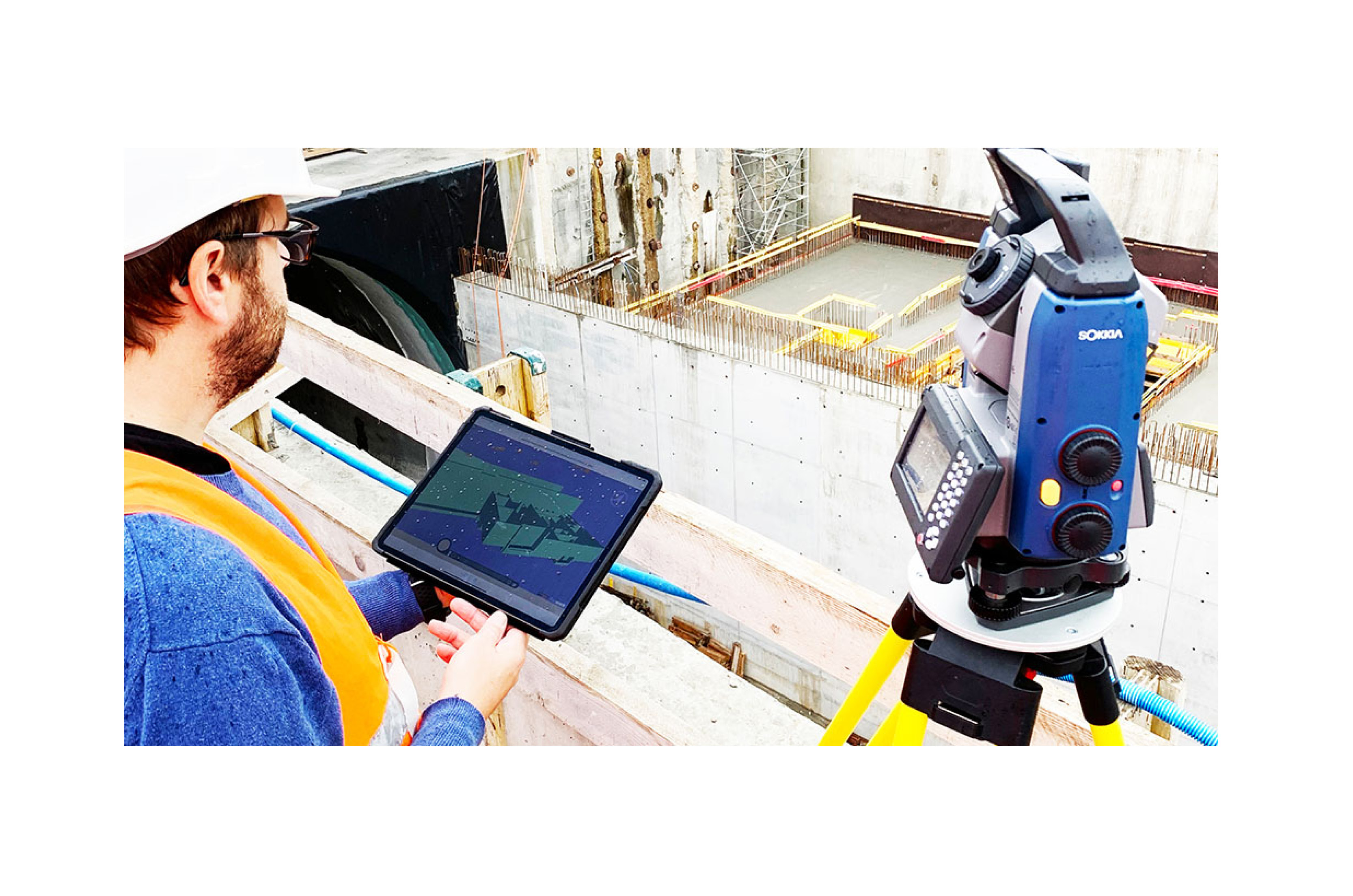
Model based measurement
BIMteam
Our BIM solution allows contractors to link the coordinated 3D construction model to the construction site. Immediately after pairing with a total station or GNSS, you are guided to the exact position of the desired points on the construction site. Control of the total station or GNSS takes place directly from the viewer. Currently, surveys and stakeouts of the total stations or GNSS listed below can be performed. Contact us for more information about the latest developments.
Learn more at www.bimteam.com